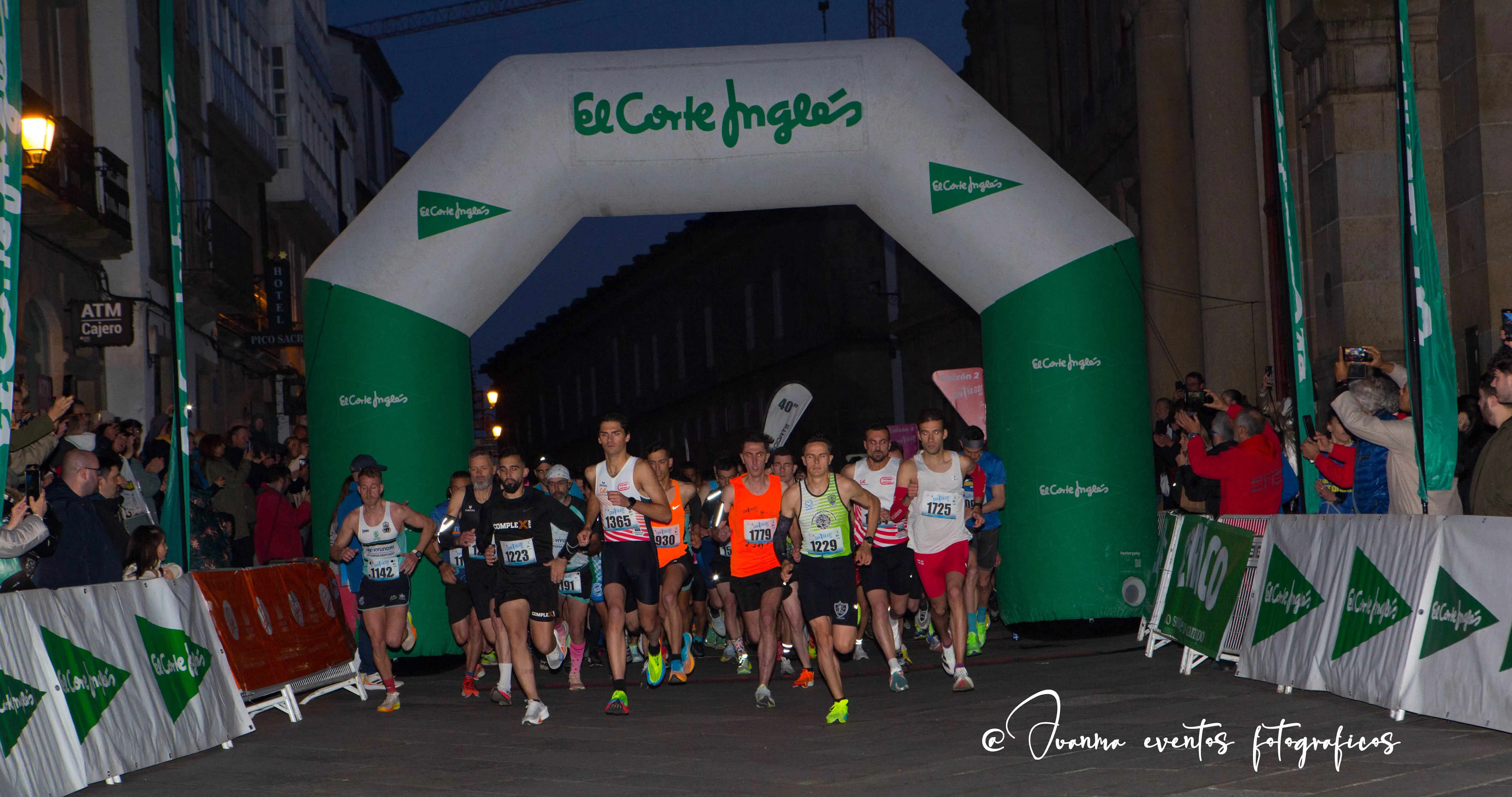
Track 10K
A route through the monumental old town of the Galician capital. What more could you ask for?
You can hide and show the menu by clicking this button on the map:
The 10K Circuit
The total length of the circuit is 10,000 meters, 10 km, and it is homologated by the Royal Spanish Athletics Federation.
On this map you can see both the route and the key points (start, kilometer markers...) and places of interest (showers, restaurants, hotels...).
Start
Rúa de San Francisco
Finish
Praza do Obradoiro
Download the route
To access the technical route on Track GPS, we have published the route here:
SantYaGo10K - 2026 - plotaroute.comBy Kilometer
Start (KP 0)
- Rúa de San Francisco
View the Route
Watch the video and discover the complete race route
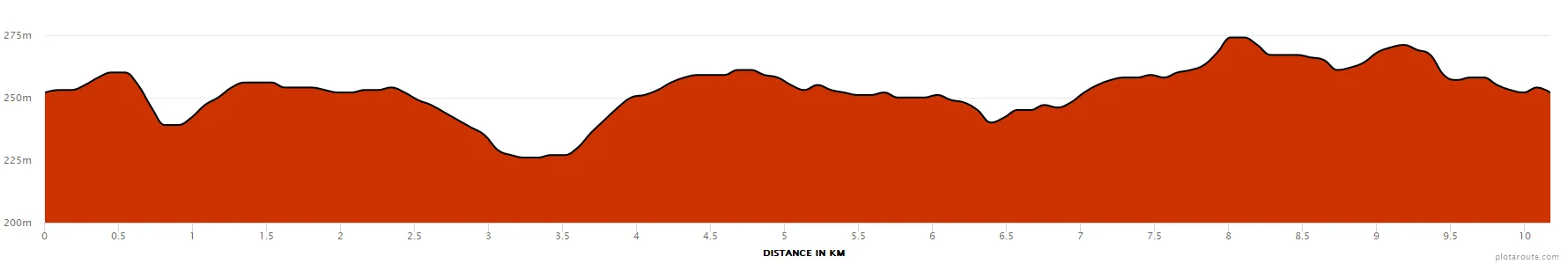
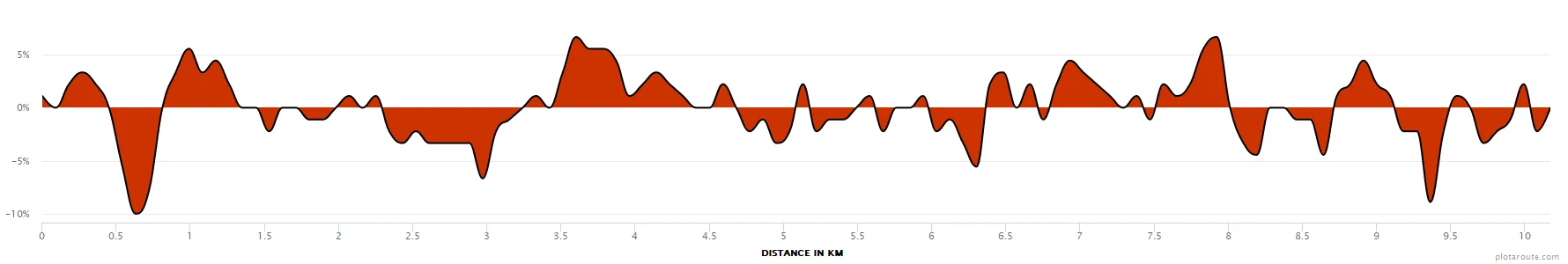
Altimetry
Total distance
10 km (10,000 m)
Total Ascent / Descent
115 m / 115 m
Lowest point
226 m (KM 3.24)
Highest point
274 m (KM 8.01)
Uphill
4.23 km (41.4%)
Downhill
3.87 km (37.9%)
Flat
2.07 km (20.3%)
Steepest uphill
+6.7% (KM 3.60)
Steepest downhill
-10% (KM 0.63)
Longest uphill
1.44 km (KM 3.33)
Longest downhill
0.99 km (KM 2.34)
Altitude gain
48 m
Elevation in Meters
Elevation in Percentage
Sponsors